DREMANN GRASSLAND SCALE (DGS). Utilizing the photos below, I am suggesting rating the quality of the native grass understory using the following scale:
New Mexico ecological and vegetation photo megatransect in cross-sections, running east to west along each degree of north latitude.
Compiled by Craig Dremann, (650) 325-7333, for scientific study of what a large-scale, continent-sized ecological and vegetation photo megatransect could possibly look like, photos copyright by the photographers that are listed on the pages at confluence.com. Photos on this web page are used here with written permission from the Confluence Project.
The best index link into the Confluence project is https://www.confluence.org/showworld.php
>>>See the Europe to Africa Vegetation Megatransect HERE
>>>Canada to Mexico Vegetation Megatransect HERE
>>>Canada to Baja Vegetation Megatransect HERE
>>>China West to East Vegetation Megatransect HERE
>>>Pakistan through India Vegetation Megatransect HERE
>>>North Africa to India Vegetation Megatransect HERE
>>>Australia Vegetation Megatransect HERE
>>>United States West to East Vegetation Megatransect HERE
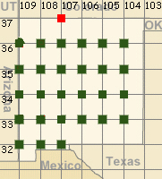
Green dots show the locations for each photo of this megatransect.
Nearby towns are noted for each picture.
Some photos have been cropped or have had their contrast enhanced,
to show the vegetation more clearly.
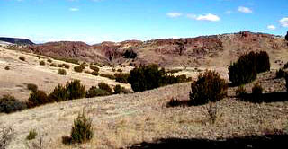
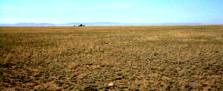
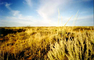
DREMANN GRASSLAND SCALE
(DGS). Utilizing the photos below, I am suggesting rating
the quality of the native grass understory using the following
scale:
Scale goes from minus 10 to 0 to positive 10.
0 equals less than 5% native grass cover, and every point in the minus zone equals no native grasses and 10% exotic plant cover.
In the positive, every point equals 10% native grass cover,
up to 80% native grass cover or 8 points. Then the 9 and 10 equals
the forbs in the interspaces, until you reach 10, which is 100%
native grass and forb cover.
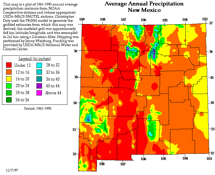
Annual = annual average maximum total number of inches
of rainfall for that site, according to the above map.
Grassland quality (DGS) and annual average maximum rainfall:
| DGS | inches | N. Lat. | W. Long |
| 0 | <12 | 33 | 106 |
| 0 | <12 | 33 | 107 |
| 0 | <12 | 32 | 107 |
| 1 | <12 | 36 | 106 |
| 1 | <12 | 35 | 107 |
| 2 | <12 | 36 | 108 |
| 2 | <12 | 32 | 108 |
| 3 | <12 | 32 | 109 |
| 5 | <12 | 34 | 108 |
| -5 | 16 | 35 | 106 |
| 0 | 16 | 36 | 109 |
| 0 | 16 | 35 | 108 |
| 1 | 16 | 33 | 105 |
| 3 | 16 | 35 | 109 |
| 3 | 16 | 34 | 104 |
| 5 | 16 | 34 | 106 |
| 6 | 16 | 36 | 104 |
| 7 | 16 | 35 | 105 |
| 7 | 16 | 33 | 104 |
| 8 | 16 | 34 | 105 |
| 4 | 20 | 34 | 107 |
| 6 | 20 | 33 | 109 |
| 7 | 20 | 35 | 104 |
| 8 | 20 | 36 | 105 |
| 7 | 24 | 33 | 108 |
| 0 | 28 | 34 | 109 |
| unknown | 16 | 36 | 107 |
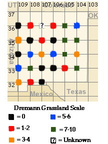
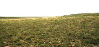
36N 104W - Roy - Annual = 16", DGS = 6
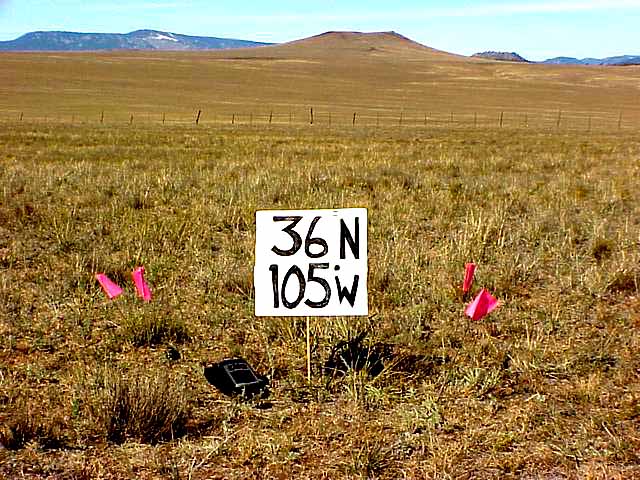 36N 105W - Ojo Feliz - DGS = Annual = 20" , DGS
= 8, perhaps higher after field-checking.
36N 105W - Ojo Feliz - DGS = Annual = 20" , DGS
= 8, perhaps higher after field-checking.
36N 106W - Santa Cruz, Annual = <12", DGS = 1
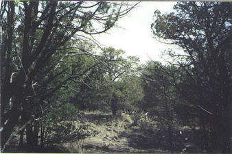
36N 107W - Cuba, Annual = 16" , DGS = unknown.
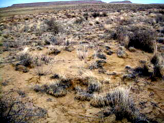
36N 108W - Seven Lakes, Annual = <12", DGS = 2
36N 109W - Crystal, Annual = 16", DGS = 0
--- East to West along 35° North latitude.
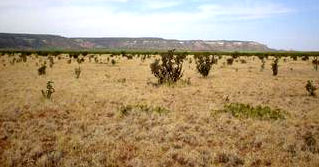
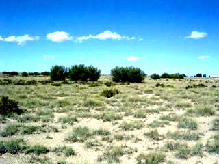
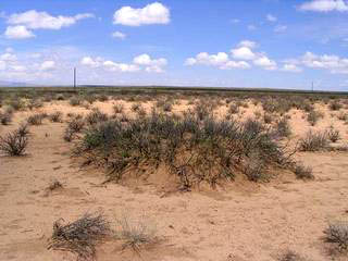
35N 104W - Montoya, Annual = 20", DGS = 7
35N 105W - I-40 Exit 256, Guadalupe, Annual = 16", DGS =
7
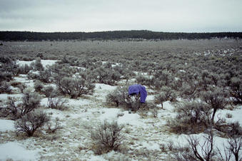
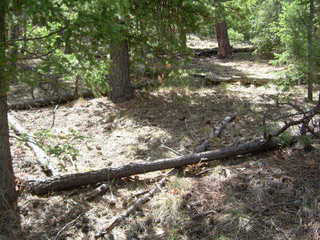
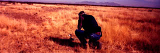
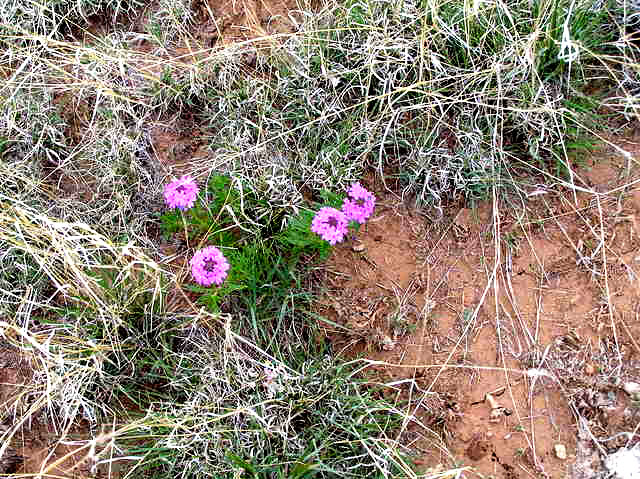 35N 105W - Close up of vegetation
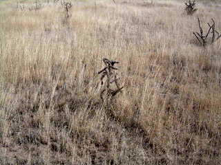
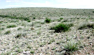
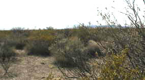
35N 106W - Moriarty, Annual = 16", DGS = Minus 5, cheatgrass?
Site needs field checking for confirmation. Could also be native
annual grasses instead of exotics.
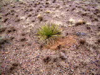
35N 107W - I-40 Exit Cibola, Annual = <12", DGS = 1
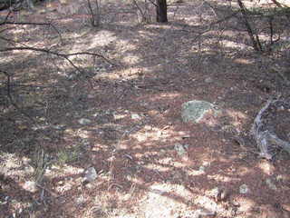
35N 108W - Grants, Annual = 16", DGS = 0
35N 109W - Tekapo, Annual = 16", DGS = 3
--- East to West along 34° North latitude.
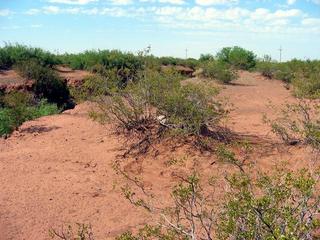
34N 104W - Kenna, Annual = 16", DGS = 3
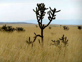
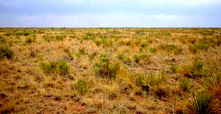
34N 105W - Ramon, Annual = 16" , DGS = 8
34N 106W - Claunch, Annual = 16", DGS = 5
34N 107W - Socorro, Annual = 20" , DGS = 4
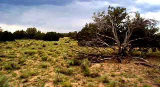
34N 108W - Datil, Annual = <12", DGS = 5
34N 109W - Luna, Annual = 28" , DGS = 0
--- East to West along 33° North latitude.
33N 104W - Hagerman, Annual = 16" , DGS = 7, maybe much higher,
after field-checking.
33N 105W - Flying H, Chaves, Annual = 16" , DGS = 1
33N 106W - Tularosa, Annual = <12" , DGS = 0
33N 107W - Engle, Annual = <12" , DGS = 0
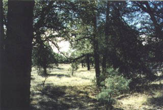
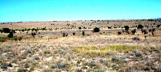
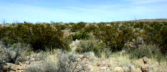
33N 108W - Mimbres, Annual = 24" , DGS = 7
33N 109W - Mule Creek, Annual = 20", DGS = 6
--- East to West along 32° North latitude.
32N 107W - La Mesa, Annual = <12", DGS = 0
32N 108W - Deming, Annual = <12" , DGS = 2
 32N 109W - Rodeo, Annual = <12", DGS = 3
Updated December 24, 2022 - The Reveg Edge Ecological Restoration service