The DUST vs The Super Category
5 Cyclone -
Atmospheric dust blocking and absorbing the Cyclone GONU, June
3-9, 2007
Copyright © 2011 by Craig Dremann,
The Reveg Edge, Box 361,
Redwood City, CA 94064 USA (650) 325-7333
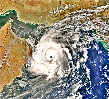 Super Tropical Cyclone GONU on June
5, 2007 as a Category 3, 110-130 mph winds. Image from
NASA's MODIS Rapid Response, contrast enhanced.
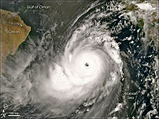 GONU at Category 5.
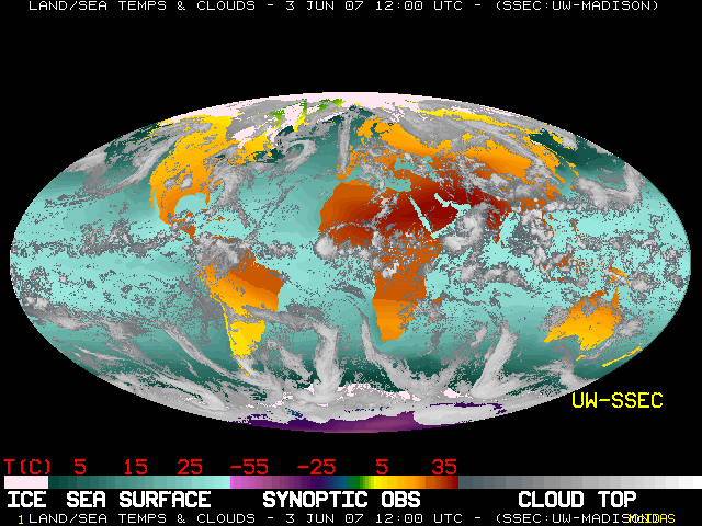
The series of images show the clouds
surrounding the Super Cyclone GONU from June 3-9 in 2007, and
the ability of the atmospheric dust to capture the storm, and
then dissipate it. The images of the clouds were from the Space
Science and Engineering Center, University of Wisconsin at Madison,
at https://www.ssec.wisc.edu/data/comp.
The images of the dust were from
the archives at the US Navy NRL/Monterey Aerosol Page, for the
Indian Ocean NAAPS at https://www.nrlmry.navy.mil/aerosol/
Both images have been cropped to
center the Cyclone, and to enlarge each image to be about the
same size, and examples of the original images are shown below.
The dust levels shown are from 20 ug/m3 to 20,480 ug/m3, but the
effect of the lowest measured levels of dust still has an impact
of the storm.
What these series of images show,
is that atmospheric dust may be the most powerful and least known
climate modifier on the planet, especially regarding annual rainfall
in the area from the Gobi desert through Arabia and North Africa.
Paired images are from the dates
at 00:00Z time.
GONU wind speeds from NASA Hurricane Archives.

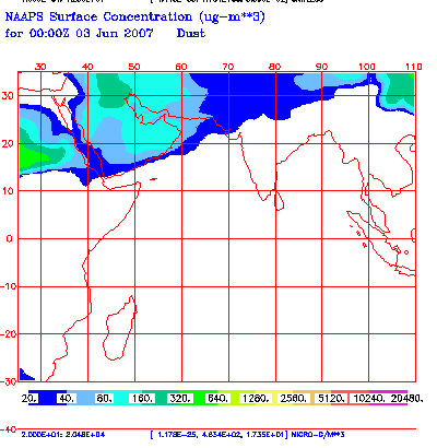
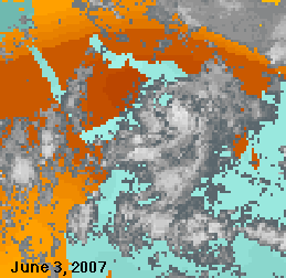
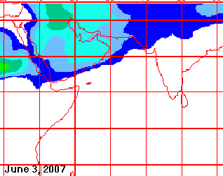 June 3, 2007, GONU bumping up against
the atmospheric dust over Arabia. 165 mph winds with gusts to
195 mph, the highest wind speed recorded in a cyclone - Category
5, a Super Tropical Cyclone.
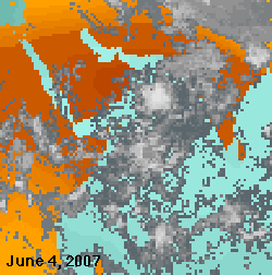
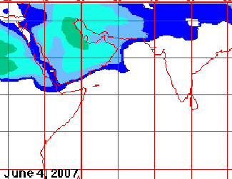 June 4, GONU making a divot in the
dust, and captured, slowing down and not making land fall yet.
132 mph winds with peak 150 mph, Category 4.
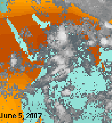
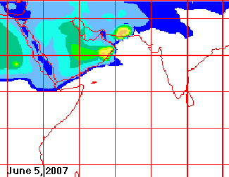 June 5, GONU securely captured in
the Gulf of Oman, with the dust acting like two sides of a vice,
with only 1,000-2,000 ug/m3 able to slow down and hold fast to
the Super Cyclone. Dust has slowed down the storm to Category
3, 111-130 mph winds.
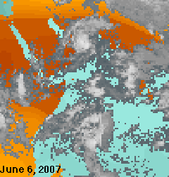
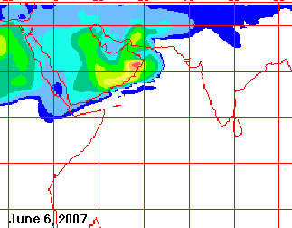 June 6, paradoxically, the faster
the winds, the more dust is raised off the barren lands of Arabia,
and that dust sucked into the cyclone, which then weakens it.
Landfall in the Sultanate of Oman at 90 mph, Category 1.
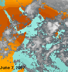
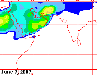 June 7, GONU completely surrounded
by atmospheric dust, about to kill the storm.
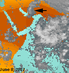
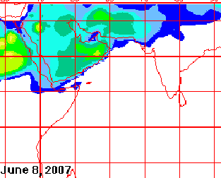 June 8, GONU surrounded by dust,
quickly dying.
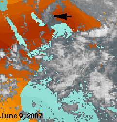
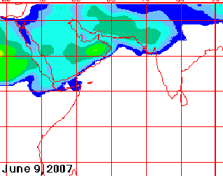 June 9, GONU is killed by the dust,
almost like an amoeba engulfing a meal. The rain clouds south
of Arabia, once again, being kept away by the dust.
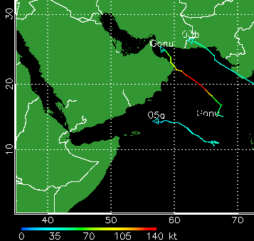
GONU track from https://www.solar.ifa.hawaii.edu/Tropical/GifArchive/nin2007.gif.
Conversion from knots to mph, 1 knot = 1.15 mph
See also https://www.ecoseeds.com/floods.html
for the Pakistan floods of 2010 and https://www.ecoseeds.com/Saudi.html
for an overall view of the Arabian rainfall, dust, vegetation
and dew point interactions.
Updated October 23, 2024 - Go to The
Reveg Edge website
 GONU at Category 5.