Cooling a planet with Revegetation,
with special attention
to the Arabian Peninsula, and a method to significantly increase
water resources of the area.
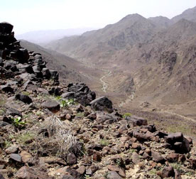
Choices for the Arabian
peninsula -- arid or abundance?
Left: Sultanate of Oman at 23N, 58E
from the Confluence project
and Vegetation photo megatransect.
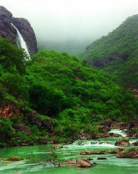
Right: Salalah in Sultanate of Oman from Oman Attractions.
By Craig Carlton Dremann - Native Grass
Research No. 14
PART 1
of this web page is at http://www.ecoseeds.com/cool.html
PART 2 of this web page is at http://www.ecoseeds.com/cool2.html
RIVERS and LAKES in ARABIA!--See where two major rivers and two lakes
were located:
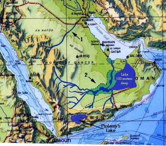
Two major Arabian peninsula rivers that could start flowing again, and two huge lakes
that could start storing water again.
River #1 was 650 miles long,
and averaged 5 miles wide and 50 feet deep along its entire length,
was studied by Boston University scientist Farouk El-Baz in 1993.
(DISCOVER, July 1993 "A river in the desert").
River #2, the Empty Quarter river and its associated lakes and marshlands, flowing through
the southern Arabian peninsula, extrapolated from five
sources:
Giant Lake, originally 100
meters deep (300 feet) can clearly be seen from Google Earth
images.
Ptolemy's lake in Yemen.
Resources:
(1.) A NASA Landsat composite of Saudi Arabia made by geology.com
posted at http://geology.com/world/saudi-arabia-satellite-image.shtml
(2.) An article about Aramco geologist Hal McClure's thesis, in
the May/June 1989 issue of Aramco World, "Lakes of the Rub'
al-Khali" -- Go to aramcoworld.com and search in Back issues.
(3.) Ancient riverbed locations from Dr. Abdallah
E. Dabbagh (et al) at King Fahd University in Dhahran,
"Geologic and Hydrologic Studies of Saudi Arabia Under the
Spaceborne Imaging Radar-C (SIR-C) Science Plan" http://southport.jpl.nasa.gov/ProgressReports0496/Dabbagh.Final.html
especially the "Figure 11 - Pleistocene drainage of Arabian
Peninsula."
http://southport.jpl.nasa.gov/ProgressReports0496/gifs/dabbagh11.gif
(4.) Philby, H. St. John B. 1933 book "The Empty Quarter:
Being a description of the Great South Desert of Arabia known
as Rub' al Khali" (pub. Henry Holt & Co. NY) on his chapter
"Forgotten Rivers" and finding river beds with fresh-water
shells.
(5.) Map Arabia Felice Nuova by Ruscelli, Venice 1574 edition,
two versions of Ptolemy's map of Arabia, with one showing the
lake in Yemen, that Ptolemy wrote about existing in Arabia. Yemen.
Originally at http://www.helmink.com/Antique_Map_Ruscalli_Arabia/
(6.) Google Earth images.
Basemap is from "The World" 1998 scale 1:30,000,000
at the equator, published by the Dept. of Defense, National Imagery
and Mapping Agency
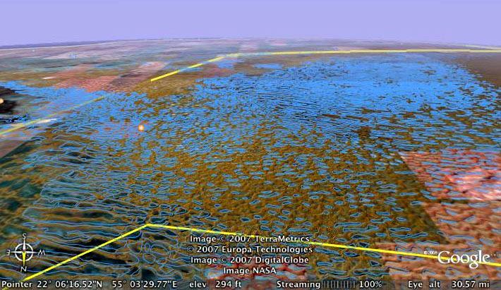
Ancient 6,000 year old, Empty Quarter lake bed, seen from
30.6 miles, Google Earth image. Looking from the UAE across KSA
into the Sultanate of Oman.
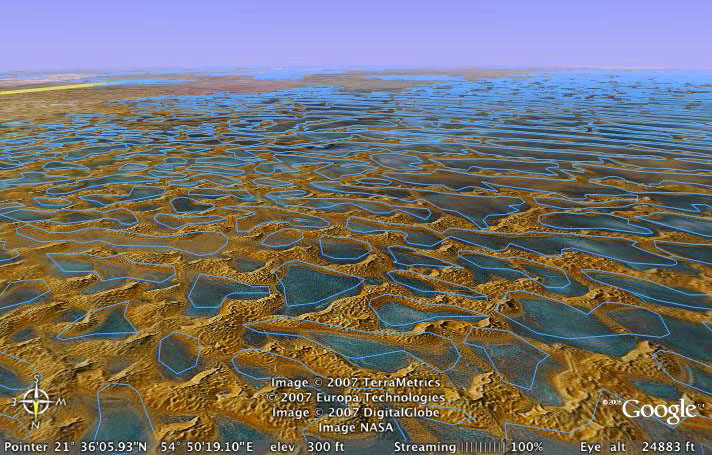
Ancient 6,000 year old, Empty Quarter lake bed, seen from
24,000 feet, Google Earth image.
ARTWORK about the return of the summer monsoonal
rains:
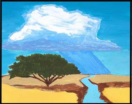
Title: "Design for a New Flag, for one of the desert countries
located between India and Morocco, to start to harvest the summer
monsoonal moisture that is passing over each season, by replanting
the local native trees like the Acacia shown in the image, plus
replant and protect the local native perennial grasses, to cool
the soil surface, lower the atmospheric dust, and encourage the
clouds to form, the rain to fall, and the streams to flow again."
Digital image, taken from the 8" x 10" acrylic
on canvas. Painting #20 in catalogue. Copyright image and text
© 2012 by Craig Carlton Dremann, all right reserved.
Updated October 23, 2024 - The Reveg
Edge Ecological Restoration service.